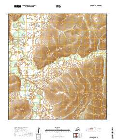
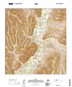
2019 Map of Iditarod B-5 NE
USGS Topo · Published 2019About this map
The settlement of Flat serves as the central focal point in this remote Alaskan landscape, situated along the banks of Otter Cr. This territory is defined by the winding course of the Iditarod River, which carves through the western portion of the sheet. The drainage patterns of the region are exceptionally clear, illustrating how numerous small tributaries like Fairbanks Cr and Trail Cr feed into the larger river system.
Find a feature on this map
15 named features on this map. Tap any name to fly to it.
Don’t see what you’re looking for? This feature index may not catch every label — zoom into the map to look around manually.
Map Details
Editions of this 2019 Iditarod B-5 NE Map
This is the sole edition of this map. No revisions or reprints were ever made.
Other maps of this area

1951 · Iditarod
USGS Topo · 1:250,000

1954 · Iditarod C-4
USGS Topo · 1:63,360

1954 · Iditarod B-5
USGS Topo · 1:63,360

1954 · Iditarod C-5
USGS Topo · 1:63,360

1954 · Iditarod B-4
USGS Topo · 1:63,360

1956 · Iditarod
USGS Topo · 1:250,000
2019 · Iditarod B-4 NW
USGS Topo · 1:25,000
2019 · Iditarod B-4 SW
USGS Topo · 1:25,000
2019 · Iditarod C-4 SW
USGS Topo · 1:25,000
2019 · Iditarod C-5 SE
USGS Topo · 1:25,000