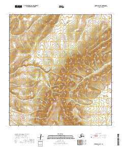
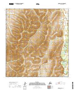
2019 Map of Iditarod D-4 SE
USGS Topo · Published 2019About this map
The Kuskokwim Mountains dominate this 2019 survey, defining a landscape of high ridges and narrow drainage basins in the interior of Alaska. This specific quadrangle captures a remote section of the Yukon-Koyukuk region where the topography rises sharply from the valleys of Glacier Cr and First Chance Cr. The map's high-resolution contour work reveals the complex serrated ridges and summits that characterize this part of the range, offering a precise view of the terrain before any significant human development or road infrastructure reached these reaches. Without settlements or industrial sites printed on the sheet, the focus remains entirely on the natural hydrology and the massive scale of the mountain system, making it a critical reference for understanding the untouched wilderness of the Alaskan interior in the early 21st century.
Find a feature on this map
7 named features on this map. Tap any name to fly to it.
Don’t see what you’re looking for? This feature index may not catch every label — zoom into the map to look around manually.
Map Details
Editions of this 2019 Iditarod D-4 SE Map
This is the sole edition of this map. No revisions or reprints were ever made.
Other maps of this area

1951 · Iditarod
USGS Topo · 1:250,000

1954 · Iditarod C-4
USGS Topo · 1:63,360

1954 · Iditarod C-3
USGS Topo · 1:63,360

1954 · Iditarod D-3
USGS Topo · 1:63,360

1954 · Iditarod D-4
USGS Topo · 1:63,360

1956 · Iditarod
USGS Topo · 1:250,000
2019 · Iditarod C-3 NW
USGS Topo · 1:25,000
2019 · Iditarod D-3 SW
USGS Topo · 1:25,000
2019 · Iditarod D-4 SW
USGS Topo · 1:25,000
2019 · Iditarod D-4 NE
USGS Topo · 1:25,000