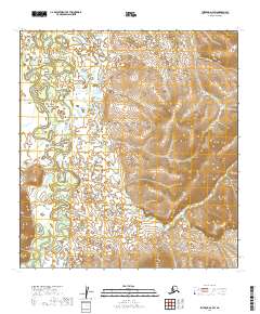
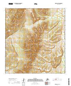
2019 Map of Iditarod D-4 SW
USGS Topo · Published 2019About this map
The Iditarod River meanders through this landscape within the Yukon-Koyukuk Census Area, defining a low-lying basin characterized by complex hydrology. Numerous small tributaries, including First Chance Cr and Twin Island Cr, drain into the main river channel from the surrounding hills. This 2019 survey documents the intricate network of wetlands and ponds that dominate the central sections of the quadrangle. The terrain transitions from these water-logged lowlands to higher elevations in the east and west, where labels like Glacier Cr and Moose Cr indicate the start of the watershed's feeder streams. The lack of named roads or settlements underscores the wilderness character of this region, reflecting a landscape primarily shaped by natural drainage patterns rather than human infrastructure.
Find a feature on this map
11 named features on this map. Tap any name to fly to it.
Don’t see what you’re looking for? This feature index may not catch every label — zoom into the map to look around manually.
Map Details
Editions of this 2019 Iditarod D-4 SW Map
This is the sole edition of this map. No revisions or reprints were ever made.
Other maps of this area

1951 · Iditarod
USGS Topo · 1:250,000

1954 · Iditarod C-4
USGS Topo · 1:63,360

1954 · Iditarod C-5
USGS Topo · 1:63,360

1954 · Iditarod D-5
USGS Topo · 1:63,360

1954 · Iditarod D-4
USGS Topo · 1:63,360

1956 · Iditarod
USGS Topo · 1:250,000
2019 · Iditarod D-4 NE
USGS Topo · 1:25,000
2019 · Iditarod D-4 SE
USGS Topo · 1:25,000
2019 · Iditarod D-4 NW
USGS Topo · 1:25,000
2019 · Iditarod C-4 NE
USGS Topo · 1:25,000