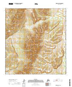
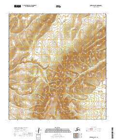
2019 Map of Iditarod C-4 NE
USGS Topo · Published 2019About this map
Dishna River winds through the southeastern corner of this interior Alaska landscape, providing a primary drainage for the surrounding highlands. The terrain is defined by complex drainage networks, including the headwaters of Hickey Cr and Twin Island Cr, which carve through the high elevations of the t30n r45w and t31n r45w townships. These watercourses imply a remote, undeveloped wilderness typical of the Yukon-Koyukuk region, where the natural topography remains the dominant feature. The map provides a precise layout of the Public Land Survey System grid across this uninhabited territory, showing the relationship between the upland ridges and the lower basin of the Dishna River.
Find a feature on this map
9 named features on this map. Tap any name to fly to it.
Don’t see what you’re looking for? This feature index may not catch every label — zoom into the map to look around manually.
Map Details
Editions of this 2019 Iditarod C-4 NE Map
This is the sole edition of this map. No revisions or reprints were ever made.
Other maps of this area

1951 · Iditarod
USGS Topo · 1:250,000

1954 · Iditarod C-4
USGS Topo · 1:63,360

1954 · Iditarod C-3
USGS Topo · 1:63,360

1954 · Iditarod D-3
USGS Topo · 1:63,360

1954 · Iditarod D-4
USGS Topo · 1:63,360

1956 · Iditarod
USGS Topo · 1:250,000
2019 · Iditarod C-3 NW
USGS Topo · 1:25,000
2019 · Iditarod D-3 SW
USGS Topo · 1:25,000
2019 · Iditarod D-4 SW
USGS Topo · 1:25,000
2019 · Iditarod D-4 SE
USGS Topo · 1:25,000