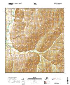
2019 Map of Iditarod C-3 NW
USGS Topo · Published 2019About this map
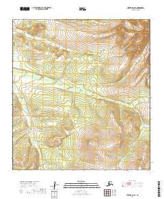
The Dishna River meanders through the northwest corner of this remote Alaskan interior, defining a landscape of complex hydrological drainage and high-elevation relief. The western reaches are dominated by the river's broad floodplains and oxbows, while the central and eastern sections are characterized by a network of steep-cut valleys and upland ridges. These drainages include the prominent Porcupine Creek and its southern tributary Guggenheim Cr, as well as the easterly Deadwood Cr. The survey illustrates the difficult topography of the Yukon-Koyukuk region, where small seasonal waterways like Saint Patrick Cr carve through the terrain. The lack of roads or structures emphasizes the wilderness character of the area, typical of the Iditarod mining district's hinterlands where development is restricted to the watercourses that once guided prospectors and surveyors.
Find a feature on this map
12 named features on this map. Tap any name to fly to it.
Don’t see what you’re looking for? This feature index may not catch every label — zoom into the map to look around manually.
Map Details
Editions of this 2019 Iditarod C-3 NW Map
This is the sole edition of this map. No revisions or reprints were ever made.
Other maps of this area

1951 · Iditarod
USGS Topo · 1:250,000

1954 · Iditarod C-4
USGS Topo · 1:63,360

1954 · Iditarod C-3
USGS Topo · 1:63,360

1954 · Iditarod D-3
USGS Topo · 1:63,360

1954 · Iditarod D-4
USGS Topo · 1:63,360

1956 · Iditarod
USGS Topo · 1:250,000
2019 · Iditarod D-3 SW
USGS Topo · 1:25,000
2019 · Iditarod C-3 SE
USGS Topo · 1:25,000
2019 · Iditarod C-3 NE
USGS Topo · 1:25,000
2019 · Iditarod D-3 SE
USGS Topo · 1:25,000