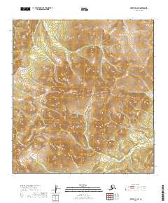
2019 Map of Iditarod C-3 NE
USGS Topo · Published 2019About this map
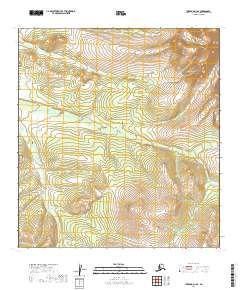
Moose Cr and Maybe Cr carve through the high terrain of the Yukon-Koyukuk region, defining a drainage pattern that has long influenced navigation in this part of the Alaskan interior. This 2019 survey captures a landscape dominated by its hydrography, where narrow valleys like those of Deadwood Cr and Saint Patrick Cr separate significant ridgelines. The southeastern portion of the map is defined by the winding course of Fourth of July Cr, while the southern reaches show the headwaters of Willow Cr and Little Willow Cr. These named watercourses serve as the primary geographic markers in an area without permanent settlements, providing essential data for those studying the natural history and remote hydrology of the Iditarod region.
Find a feature on this map
16 named features on this map. Tap any name to fly to it.
Don’t see what you’re looking for? This feature index may not catch every label — zoom into the map to look around manually.
Map Details
Editions of this 2019 Iditarod C-3 NE Map
This is the sole edition of this map. No revisions or reprints were ever made.
Other maps of this area

1951 · Iditarod
USGS Topo · 1:250,000

1954 · Iditarod C-3
USGS Topo · 1:63,360

1954 · Iditarod C-2
USGS Topo · 1:63,360

1954 · Iditarod D-2
USGS Topo · 1:63,360

1954 · Iditarod D-3
USGS Topo · 1:63,360

1956 · Iditarod
USGS Topo · 1:250,000
2019 · Iditarod C-3 NW
USGS Topo · 1:25,000
2019 · Iditarod D-3 SW
USGS Topo · 1:25,000
2019 · Iditarod C-3 SE
USGS Topo · 1:25,000
2019 · Iditarod D-3 SE
USGS Topo · 1:25,000