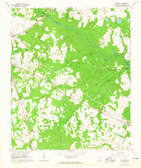
1964 Map of Idlewood
USGS Topo · Published 1965About this map
The eastern outskirts of Waynesboro and the rural Burke County landscape come into focus during the mid-1960s, a period characterized by small crossroads settlements and a dense network of country churches. The Central Georgia railroad cuts through the western edge of the map, while an Old Railroad Grade serves as a reminder of former transit lines through the pine-dotted terrain. This survey provides an invaluable record for genealogists, as it identifies numerous local landmarks including Watkinville Ch, Second Springfield Ch, and the Asbury Ch with its adjacent cemetery.
Find a feature on this map
34 named features on this map. Tap any name to fly to it.
Don’t see what you’re looking for? This feature index may not catch every label — zoom into the map to look around manually.
Map Details
Editions of this 1964 Idlewood Map
2 editions found
Other maps of this area

1919 · Gough
USGS Topo · 1:62,500

1920 · Millen
USGS Topo · 1:62,500

1920 · Greens Cut
USGS Topo · 1:62,500

1943 · Greens Cut
USGS Topo · 1:62,500

1943 · Millen
USGS Topo · 1:62,500

1943 · Augusta East
USGS Topo · 1:125,000

1943 · Millen
USGS Topo · 1:125,000

1947 · Savannah
USGS Topo · 1:250,000

1948 · Savannah
USGS Topo · 1:250,000

1948 · Gough
USGS Topo · 1:62,500