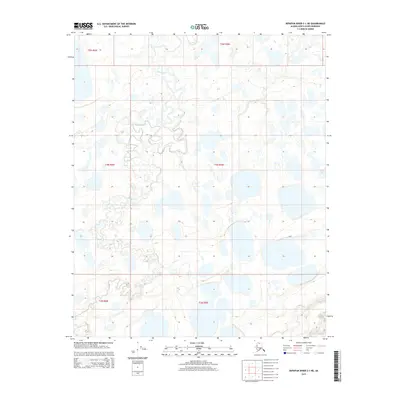
2015 Map of Ikpikpuk River C-1 NE
USGS Topo · Published 2015About this map
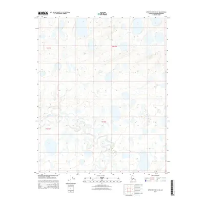
Key Creek meanders through this remote portion of the North Slope, defining a landscape dominated by intricate thaw lakes and marshy lowlands. This 2015 survey, produced by the U.S. Geological Survey, captures a characteristic stretch of Arctic tundra where water dictates the geography. In the southern reach of the quadrangle, Judy Cr emerges, cutting through the low-relief terrain. The map's high-resolution contour data reveals the subtle elevations and depressions typical of permafrost-influenced environments, where even minor changes in topography shift the path of Key Cr. This representation provides researchers with a baseline of the hydrologic patterns and drainage networks in the Ikpikpuk River basin before further environmental shifts occur.
Find a feature on this map
9 named features on this map. Tap any name to fly to it.
Don’t see what you’re looking for? This feature index may not catch every label — zoom into the map to look around manually.
Map Details
Editions of this 2015 Ikpikpuk River C-1 NE Map
This is the sole edition of this map. No revisions or reprints were ever made.
Other maps of this area

1951 · Ikpikpuk River
USGS Topo · 1:250,000

1952 · Umiat
USGS Topo · 1:250,000
1955 · Umiat D-5
USGS Topo · 1:63,360

1955 · Umiat C-5
USGS Topo · 1:63,360

1956 · Ikpikpuk River
USGS Topo · 1:250,000

1956 · Umiat
USGS Topo · 1:250,000

1964 · Umiat
USGS Topo · 1:250,000
1984 · Ikpikpuk River D-1
USGS Topo · 1:63,360
1985 · Ikpikpuk River C-1
USGS Topo · 1:63,360
2015 · Ikpikpuk River D-1 SE
USGS Topo · 1:25,000