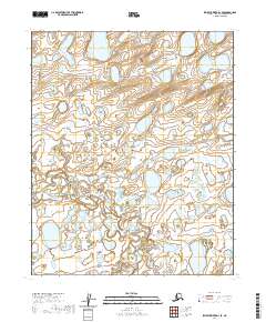
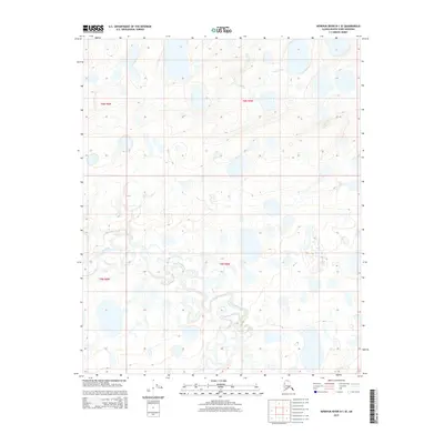
2020 Map of Ikpikpuk River D-1 SE
USGS Topo · Published 2020About this map
Fish Creek and Fish Cr weave through this northern landscape, defining a complex network of wetlands and tundra ponds. This 2020 U.S. Geological Survey topographic study captures the hydrological character of the North Slope, where seasonal drainage patterns like Key Creek create a shifting mosaic of water and land. The map illustrates the Public Land Survey System grid with designations such as t6n r5w and t5n r5w, reflecting the systematic administrative division of this remote Arctic region. The absence of roads or permanent settlements highlights the wilderness character of the terrain, making this a specialized resource for understanding the natural drainage of the Ikpikpuk River basin.
Find a feature on this map
9 named features on this map. Tap any name to fly to it.
Don’t see what you’re looking for? This feature index may not catch every label — zoom into the map to look around manually.
Map Details
Editions of this 2020 Ikpikpuk River D-1 SE Map
This is the sole edition of this map. No revisions or reprints were ever made.
Other maps of this area

1951 · Ikpikpuk River
USGS Topo · 1:250,000

1952 · Umiat
USGS Topo · 1:250,000
1955 · Umiat D-5
USGS Topo · 1:63,360

1955 · Umiat C-5
USGS Topo · 1:63,360

1956 · Ikpikpuk River
USGS Topo · 1:250,000

1956 · Umiat
USGS Topo · 1:250,000

1964 · Umiat
USGS Topo · 1:250,000
1984 · Ikpikpuk River D-1
USGS Topo · 1:63,360
1985 · Ikpikpuk River C-1
USGS Topo · 1:63,360
2015 · Ikpikpuk River D-1 SE
USGS Topo · 1:25,000