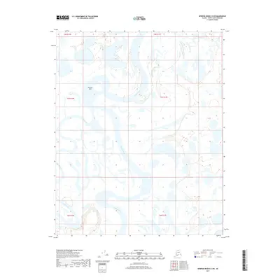
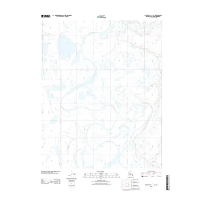
2017 Map of Ikpikpuk River D-3 NW
USGS Topo · Published 2017About this map
The Ikpikpuk River dominates this remote Arctic landscape, carving a highly sinuous path through the North Slope tundra. This 2017 survey documents the intricate hydrologic patterns of the region, featuring the dramatic oxbow at Semiutak Bend. The terrain is characterized by a dense network of thaw lakes and smaller watercourses, including the Titaluk River, which flows through the southwestern corner of the quadrangle. As a modern digital-age record, the map reflects the ongoing shifts in Arctic water systems within the Public Land Survey System grids of t7n r12w and t8n r11w. The lack of human settlements or infrastructure emphasizes the wilderness character of this area, where the river's migration is the primary driver of change on the land.
Find a feature on this map
9 named features on this map. Tap any name to fly to it.
Don’t see what you’re looking for? This feature index may not catch every label — zoom into the map to look around manually.
Map Details
Editions of this 2017 Ikpikpuk River D-3 NW Map
This is the sole edition of this map. No revisions or reprints were ever made.
Other maps of this area
1951 · Teshekpuk
USGS Topo · 1:250,000

1951 · Ikpikpuk River
USGS Topo · 1:250,000
1955 · Teshekpuk
USGS Topo · 1:250,000
1955 · Teshekpuk A-3
USGS Topo · 1:63,360
1955 · Teshekpuk A-4
USGS Topo · 1:63,360

1956 · Ikpikpuk River
USGS Topo · 1:250,000
1964 · Teshekpuk
USGS Topo · 1:250,000
1984 · Ikpikpuk River D-3
USGS Topo · 1:63,360
1985 · Ikpikpuk River D-4
USGS Topo · 1:63,360
2013 · Teshekpuk A-3 SW
USGS Topo · 1:25,000