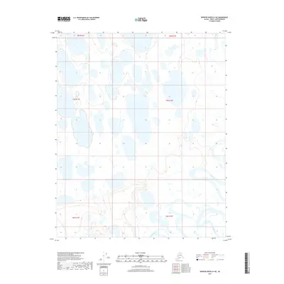
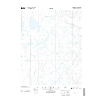
2017 Map of Ikpikpuk River D-4 NE
USGS Topo · Published 2017About this map
The Titaluk River winds through the southeastern corner of this North Slope landscape, carving a distinct hydrological pattern across the Arctic coastal plain. This 2017 survey reveals an environment dominated by an intricate network of thermokarst lakes and ponded water, reflecting the unique permafrost-driven geography of the region. The map captures the sheer density of these water bodies, which vary from small circular pools to larger, irregular basins that shift as the underlying ground freezes and thaws. Unlike the more developed regions of the south, this area is defined by its lack of permanent settlements or infrastructure, providing a clear record of the untouched drainage systems within the Ikpikpuk River watershed. The vast expanse shown here represents a critical look at the topographic character of the northern tundra as it existed in the early 21st century.
Find a feature on this map
7 named features on this map. Tap any name to fly to it.
Don’t see what you’re looking for? This feature index may not catch every label — zoom into the map to look around manually.
Map Details
Editions of this 2017 Ikpikpuk River D-4 NE Map
This is the sole edition of this map. No revisions or reprints were ever made.
Other maps of this area
1951 · Teshekpuk
USGS Topo · 1:250,000

1951 · Ikpikpuk River
USGS Topo · 1:250,000
1955 · Teshekpuk
USGS Topo · 1:250,000
1955 · Teshekpuk A-3
USGS Topo · 1:63,360
1955 · Teshekpuk A-4
USGS Topo · 1:63,360

1956 · Ikpikpuk River
USGS Topo · 1:250,000
1964 · Teshekpuk
USGS Topo · 1:250,000
1984 · Ikpikpuk River D-3
USGS Topo · 1:63,360
1985 · Ikpikpuk River D-4
USGS Topo · 1:63,360
2013 · Teshekpuk A-3 SW
USGS Topo · 1:25,000