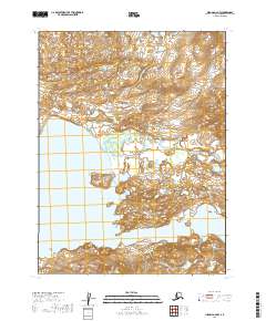
2019 Map of Iliamna A-6 NW
USGS Topo · Published 2019About this map
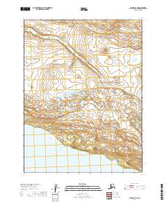
Katmai National Preserve dominates this portion of the Alaska Peninsula, protecting a wild landscape where water and topography define the boundaries of human reach. The southwestern corner of the sheet is marked by the expansive waters of Kukaklek Lake, a critical geographic feature in this part of the Lake and Peninsula Borough. From the high country, Moraine Creek winds its way through glacial terrain, eventually feeding into the larger lake system. Near the southern edge of the survey, Narrow Cove provides a distinct indentation in the shoreline, illustrating the complex hydrology of the region. This 2019 survey documents a landscape preserved in its natural state, showing no roads or permanent settlements, emphasizing the role of federal conservation in maintaining the character of the Alaskan interior.
Find a feature on this map
8 named features on this map. Tap any name to fly to it.
Don’t see what you’re looking for? This feature index may not catch every label — zoom into the map to look around manually.
Map Details
Editions of this 2019 Iliamna A-6 NW Map
This is the sole edition of this map. No revisions or reprints were ever made.
Other maps of this area

1951 · Iliamna A-7
USGS Topo · 1:63,360

1951 · Iliamna B-7
USGS Topo · 1:63,360

1951 · Iliamna B-6
USGS Topo · 1:63,360

1951 · Iliamna A-6
USGS Topo · 1:63,360

1952 · Iliamna
USGS Topo · 1:250,000
1954 · Iliamna B-6
USGS Topo · 1:63,360

1957 · Iliamna
USGS Topo · 1:250,000
2019 · Iliamna A-7 NE
USGS Topo · 1:25,000
2019 · Iliamna B-7 SE
USGS Topo · 1:25,000
2019 · Iliamna A-7 SE
USGS Topo · 1:25,000