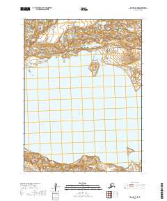
2019 Map of Iliamna A-7 NE
USGS Topo · Published 2019About this map
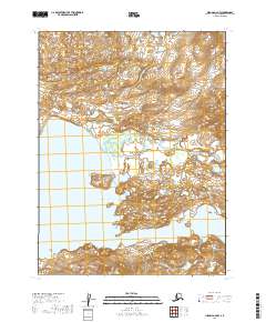
Katmai National Preserve encompasses the upper reaches of this landscape, where the northern shoreline of Kukaklek Lake meets a complex network of glacial topography. This survey highlights the transition from the deep waters of the lake to the rising elevations of the interior, featuring the prominent Bear Island near the northern shore. The cartography focuses on the uninhabited wilderness of the Lake and Peninsula Borough, documenting the shoreline and the surrounding mountain foothills without modern infrastructure or permanent settlements. The land management is defined by large-scale federal protections and the Public Land Survey System grids, including t11s r36w and t12s r36w, which structure the remote backcountry of southwestern Alaska.
Find a feature on this map
7 named features on this map. Tap any name to fly to it.
Don’t see what you’re looking for? This feature index may not catch every label — zoom into the map to look around manually.
Map Details
Editions of this 2019 Iliamna A-7 NE Map
This is the sole edition of this map. No revisions or reprints were ever made.
Other maps of this area

1951 · Iliamna A-7
USGS Topo · 1:63,360

1951 · Iliamna B-7
USGS Topo · 1:63,360

1951 · Iliamna B-6
USGS Topo · 1:63,360

1951 · Iliamna A-6
USGS Topo · 1:63,360

1952 · Iliamna
USGS Topo · 1:250,000
1954 · Iliamna B-6
USGS Topo · 1:63,360

1957 · Iliamna
USGS Topo · 1:250,000
2019 · Iliamna B-7 SW
USGS Topo · 1:25,000
2019 · Iliamna A-7 SW
USGS Topo · 1:25,000
2019 · Iliamna A-6 NW
USGS Topo · 1:25,000