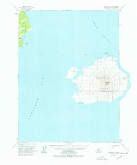
1958 Map of Iliamna B-2
USGS Topo · Published 1978About this map
Augustine Volcano dominates this maritime survey, rising from the center of Augustine Island within the waters of south-central Alaska. Based on late-1950s observations, the map illustrates the geological isolation of this volcanic peak, surrounded by Cook Inlet and Kamishak Bay. Human presence is minimal, marked only by a lone Cabin on the western shore and a rudimentary Tractor Trail that skirts the southern base of the mountain.
Find a feature on this map
10 named features on this map. Tap any name to fly to it.
Don’t see what you’re looking for? This feature index may not catch every label — zoom into the map to look around manually.
Map Details
Editions of this 1958 Iliamna B-2 Map
3 editions found
Other maps of this area

1949 · Iliamna C-1
USGS Topo · 1:63,360

1951 · Iliamna A-3
USGS Topo · 1:63,360

1951 · Iliamna A-1 and A-2
USGS Topo · 1:63,360

1952 · Iliamna
USGS Topo · 1:250,000

1954 · Iliamna C-3
USGS Topo · 1:63,360

1954 · Iliamna B-3
USGS Topo · 1:63,360

1957 · Iliamna
USGS Topo · 1:250,000

1958 · Iliamna C-2
USGS Topo · 1:63,360

1958 · Iliamna B-2
USGS Topo · 1:63,360

1958 · Iliamna C-1
USGS Topo · 1:63,360