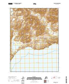
2018 Map of Iliamna B-3 NE
USGS Topo · Published 2018About this map
The coastal interface of the Pacific Ocean meets a rugged stretch of the Kenai Peninsula in this 2018 survey. The landscape is defined by dramatic elevation changes rising directly from the shoreline, most notably at the steep promontory of Fortification Bluff. Inland, the terrain is dominated by the prominence of Step Mtn, with drainage systems like Sunday Cr carving through the high country. These features characterize a wilderness area largely devoid of human infrastructure, where the natural topography dictates the movement of water and the accessibility of the coast. Near the western edge of the sheet, Kirschner Lake sits at a lower elevation, providing a rare freshwater feature in a quadrangle otherwise defined by maritime exposure and high-altitude ridges.
Find a feature on this map
9 named features on this map. Tap any name to fly to it.
Don’t see what you’re looking for? This feature index may not catch every label — zoom into the map to look around manually.
Map Details
Editions of this 2018 Iliamna B-3 NE Map
This is the sole edition of this map. No revisions or reprints were ever made.
Other maps of this area

1952 · Iliamna
USGS Topo · 1:250,000

1954 · Iliamna C-3
USGS Topo · 1:63,360

1954 · Iliamna B-3
USGS Topo · 1:63,360

1957 · Iliamna
USGS Topo · 1:250,000

1958 · Iliamna C-2
USGS Topo · 1:63,360

1958 · Iliamna B-2
USGS Topo · 1:63,360
2018 · Iliamna B-2 NW
USGS Topo · 1:25,000
2018 · Iliamna C-3 SE
USGS Topo · 1:25,000

2018 · Iliamna B-2 SW
USGS Topo · 1:25,000
2018 · Iliamna B-3 SE
USGS Topo · 1:25,000