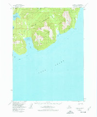
1958 Map of Iliamna C-1
USGS Topo · Published 1977About this map
Oil Bay and Cook Inlet dominate this coastal survey of the Iniskin Peninsula, where early petroleum exploration left a distinct footprint on the remote terrain. Evidence of mid-century industrial interest is scattered across the landscape, notably the presence of an Oil Well and Oil Wells near the northern interior, supported by a remote Landing Strip and a Tractor Trail cutting through the hills.
Find a feature on this map
33 named features on this map. Tap any name to fly to it.
Don’t see what you’re looking for? This feature index may not catch every label — zoom into the map to look around manually.
Map Details
Editions of this 1958 Iliamna C-1 Map
3 editions found
Other maps of this area

1949 · Iliamna C-1
USGS Topo · 1:63,360

1951 · Seldovia
USGS Topo · 1:250,000

1952 · Iliamna
USGS Topo · 1:250,000

1957 · Iliamna
USGS Topo · 1:250,000

1958 · Iliamna D-2
USGS Topo · 1:63,360

1958 · Iliamna C-2
USGS Topo · 1:63,360

1958 · Iliamna D-1
USGS Topo · 1:63,360

1958 · Iliamna B-2
USGS Topo · 1:63,360

1958 · Iliamna C-1
USGS Topo · 1:63,360
1958 · Seldovia D-8
USGS Topo · 1:63,360