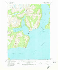
1958 Map of Iliamna C-2
USGS Topo · Published 1973About this map
Williamsport sits at the head of Iliamna Bay, serving as a critical transport node where the coastline meets the high elevations of the Chigmit Mountains. This mid-century survey documents the transition between the rugged interior peaks and the complex shoreline of Cook Inlet, characterized by tidal mudflats and rocky hazards like Black Reef and Iniskin Rock. Further south, the settlement of Dutton (Aband) is recorded on the shores of Cottonwood Bay, indicating the shifting nature of coastal habitation in this era. The terrain is defined by dramatic relief, ranging from the sea-level Mushroom Islets to the 2,800-foot summit of Brown Peak. Geologic and maritime features are prominent, including the distinct The Toadstools rock formations in Iniskin Bay and the specialized infrastructure at North Iniskin Base, reflecting the area's utility for both aviation and marine navigation during the late 1950s.
Find a feature on this map
38 named features on this map. Tap any name to fly to it.
Don’t see what you’re looking for? This feature index may not catch every label — zoom into the map to look around manually.
Map Details
Editions of this 1958 Iliamna C-2 Map
3 editions found
Other maps of this area

1949 · Iliamna C-1
USGS Topo · 1:63,360

1952 · Iliamna
USGS Topo · 1:250,000

1954 · Iliamna D-3
USGS Topo · 1:63,360

1954 · Iliamna C-3
USGS Topo · 1:63,360

1954 · Iliamna B-3
USGS Topo · 1:63,360

1957 · Iliamna
USGS Topo · 1:250,000

1958 · Iliamna D-2
USGS Topo · 1:63,360

1958 · Iliamna C-2
USGS Topo · 1:63,360

1958 · Iliamna D-1
USGS Topo · 1:63,360

1958 · Iliamna B-2
USGS Topo · 1:63,360