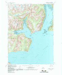
1958 Map of Iliamna C-2
USGS Topo · Published 1983About this map
Williamsport sits at the head of Iliamna Bay, serving as a critical transfer point between the marine waters of Cook Inlet and the interior. This mid-century coastal survey documents the logistical infrastructure of the Kenai Peninsula, notably the Old Iliamna 59 Mi trail leading westward from the coast. To the south, the settlement at Dutton is already marked as abandoned, reflecting the shifting patterns of habitation in this maritime environment.
Find a feature on this map
32 named features on this map. Tap any name to fly to it.
Don’t see what you’re looking for? This feature index may not catch every label — zoom into the map to look around manually.
Map Details
Editions of this 1958 Iliamna C-2 Map
3 editions found
Other maps of this area

1949 · Iliamna C-1
USGS Topo · 1:63,360

1952 · Iliamna
USGS Topo · 1:250,000

1954 · Iliamna D-3
USGS Topo · 1:63,360

1954 · Iliamna C-3
USGS Topo · 1:63,360

1954 · Iliamna B-3
USGS Topo · 1:63,360

1957 · Iliamna
USGS Topo · 1:250,000

1958 · Iliamna D-2
USGS Topo · 1:63,360

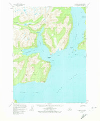
1958 · Iliamna C-2
USGS Topo · 1:63,360

1958 · Iliamna D-1
USGS Topo · 1:63,360

1958 · Iliamna B-2
USGS Topo · 1:63,360