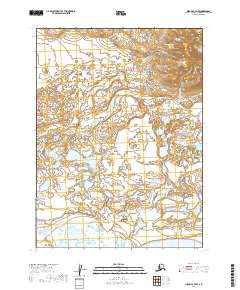
2019 Map of Iliamna C-7 NW
USGS Topo · Published 2019About this map
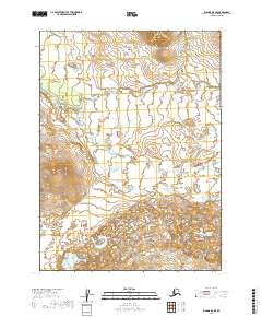
Iliamna Lake anchors the southern boundary of this 2019 survey, where the freshwater shoreline gives way to an intricate system of wetlands and tundra ponds. The landscape is defined by the winding course of Lower Talarik Cr, which meanders through the eastern portion of the map. This area is characterized by low-lying hydrography and small ponds that reflect the complex drainage patterns of the Bristol Bay watershed. The topography remains relatively flat near the lake but begins to rise toward the northeast, indicating the transition into more elevated interior terrain. The absence of roads or established settlements on the sheet underscores the remote nature of this portion of the Lake and Peninsula Borough, where natural waterways like Lower Talarik Cr serve as the primary geographic markers.
Find a feature on this map
6 named features on this map. Tap any name to fly to it.
Don’t see what you’re looking for? This feature index may not catch every label — zoom into the map to look around manually.
Map Details
Editions of this 2019 Iliamna C-7 NW Map
This is the sole edition of this map. No revisions or reprints were ever made.
Other maps of this area

1952 · Iliamna
USGS Topo · 1:250,000

1954 · Iliamna C-8
USGS Topo · 1:63,360

1954 · Iliamna D-8
USGS Topo · 1:63,360
1954 · Iliamna C-7
USGS Topo · 1:63,360

1954 · Iliamna D-7
USGS Topo · 1:63,360

1957 · Iliamna
USGS Topo · 1:250,000
2019 · Iliamna C-8 NE
USGS Topo · 1:25,000
2019 · Iliamna D-7 SW
USGS Topo · 1:25,000
2019 · Iliamna D-8 SE
USGS Topo · 1:25,000
2019 · Iliamna C-7 SE
USGS Topo · 1:25,000