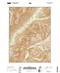
2018 Map of Iliamna D-2 NW
USGS Topo · Published 2018About this map
The Aleutian Range dominates this landscape on the boundary of the Kenai Peninsula Borough and Lake and Peninsula Borough. This 2018 survey documents a critical wilderness intersection where the protected lands of Lake Clark National Park meet the Lake Clark National Preserve. The terrain is defined by dramatic elevation changes, notably the high peaks of Three Sisters Mtn, and the hydrologic network of the Pile River. Because the map displays the precise boundary lines between the national park and preserve, it serves as a modern baseline for understanding the management of these federal lands in the early 21st century.
Find a feature on this map
10 named features on this map. Tap any name to fly to it.
Don’t see what you’re looking for? This feature index may not catch every label — zoom into the map to look around manually.
Map Details
Editions of this 2018 Iliamna D-2 NW Map
This is the sole edition of this map. No revisions or reprints were ever made.
Other maps of this area

1946 · Lake Clark
USGS Topo · 1:250,000

1951 · Lake Clark
USGS Topo · 1:250,000

1952 · Iliamna
USGS Topo · 1:250,000

1954 · Lake Clark A-3
USGS Topo · 1:63,360

1954 · Iliamna D-3
USGS Topo · 1:63,360

1957 · Iliamna
USGS Topo · 1:250,000

1958 · Iliamna D-2
USGS Topo · 1:63,360
1958 · Lake Clark A-2
USGS Topo · 1:63,360

1958 · Lake Clark
USGS Topo · 1:250,000
2018 · Iliamna D-3 SE
USGS Topo · 1:25,000