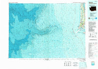
1980 Map of Ilwaco
USGS Topo · Published 1989About this map
The North Beach Peninsula serves as a narrow buffer between the Pacific and Willapa Bay, anchoring a landscape defined by its coastal settlements and maritime defenses. In this 1980 survey, the corridor from Ocean Park south to Ilwaco is meticulously detailed, showing the concentration of communities along the peninsula including Long Beach, Seaview, and Nahcotta. The map emphasizes the strategic mouth of the Columbia River, where Cape Disappointment and its namesake lighthouse overlook the treacherous waters of the bar.
Find a feature on this map
35 named features on this map. Tap any name to fly to it.
Don’t see what you’re looking for? This feature index may not catch every label — zoom into the map to look around manually.
Map Details
Editions of this 1980 Ilwaco Map
This is the sole edition of this map. No revisions or reprints were ever made.
Other maps of this area

1919 · Astoria
USGS Topo · 1:62,500

1938 · Cape Disappointment
USGS Topo · 1:62,500

1938 · Cape Shoalwater
USGS Topo · 1:62,500

1938 · Fort Columbia
USGS Topo · 1:62,500

1938 · South Bend
USGS Topo · 1:62,500

1939 · Astoria
USGS Topo · 1:62,500

1940 · Cape Falcon
USGS Topo · 1:62,500

1940 · South Bend
USGS Topo · 1:62,500

1943 · Fort Columbia
USGS Topo · 1:62,500

1943 · Copalis Beach
USGS Topo · 1:250,000