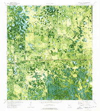
1974 Map of Immokalee 1 NW
USGS Topo · Published 1976About this map
Dinner Island and Crows Nest Hammock stand as distinct topographical rises within the sprawling wetland landscape of Hendry County. This 1974 orthophotomap, produced by the USGS in cooperation with the Florida Department of Transportation, uses aerial imagery to reveal the intricate patterns of cypress heads, prairies, and marshes that dominate the terrain. A prominent east-west boundary line separates Township 46 South and Township 47 South, while a man-made Levee and various drainage features suggest the early stages of water management in this interior region. The presence of Rocky Lake and numerous unnamed water bodies within the Slough illustrate the natural hydrology of the Everglades' western edge before significant modern development altered the drainage of the Florida peninsula.
Find a feature on this map
9 named features on this map. Tap any name to fly to it.
Don’t see what you’re looking for? This feature index may not catch every label — zoom into the map to look around manually.
Map Details
Editions of this 1974 Immokalee 1 NW Map
2 editions found
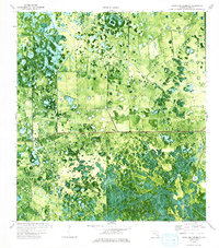
Other maps of this area

1956 · West Palm Beach
USGS Topo · 1:250,000

1957 · West Palm Beach
USGS Topo · 1:250,000

1958 · West Palm Beach
USGS Topo · 1:250,000

1958 · Felda SE
USGS Topo · 1:24,000

1958 · Sunniland
USGS Topo · 1:24,000

1958 · Immokalee NE
USGS Topo · 1:24,000

1970 · La Belle 4 SE
USGS Topo · 1:24,000

1971 · La Belle 4 SW
USGS Topo · 1:24,000

1974 · Immokalee 1 SW
USGS Topo · 1:24,000

1974 · Immokalee 1 SE
USGS Topo · 1:24,000