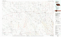
1979 Map of Imperial
USGS Topo · Published 1979About this map
Imperial serves as a primary hub in this late-1970s landscape, situated where the Burlington Northern railroad meets the southern edge of the sheet. The region is defined by a dense network of watercourses and draws that cut through the plains, including Frenchman Creek, Stinking Water Creek, and the notable Cliff Dwellers Canyon. To the north of the county seat, the Wanamaker State Wildlife Area sits just outside the town limits, providing a preserved pocket of terrain amidst the surrounding agricultural grid. Multiple small settlements like Grant, Madrid, and Elsie follow the rail corridor across Perkins and Lincoln counties. The prevalence of private aviation is evident through several regional strips such as the Reiger Landing Strip and Van Boening Landing Strip, which speak to the vast distances between these high-plains communities and their reliance on air travel for local operations.
Find a feature on this map
35 named features on this map. Tap any name to fly to it.
Don’t see what you’re looking for? This feature index may not catch every label — zoom into the map to look around manually.
Map Details
Editions of this 1979 Imperial Map
This is the sole edition of this map. No revisions or reprints were ever made.
Other maps of this area

1897 · Ogallala
USGS Topo · 1:125,000

1898 · Paxton
USGS Topo · 1:125,000

1899 · North Platte
USGS Topo · 1:125,000

1900 · Chappell
USGS Topo · 1:125,000

1900 · Ogallala
USGS Topo · 1:125,000

1901 · Paxton
USGS Topo · 1:125,000

1902 · North Platte
USGS Topo · 1:125,000

1954 · Sterling
USGS Topo · 1:250,000

1954 · Scottsbluff
USGS Topo · 1:250,000

1954 · McCook
USGS Topo · 1:250,000