
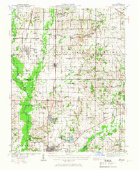
1939 Map of Ina
USGS Topo · Published 1958About this map
Agricultural prairie lands and the developing southern Illinois coal belt converge in this late 1930s survey. The landscape is defined by the Big Muddy River and its major tributaries, including Casey Fork and Gun Creek, which navigate a terrain divided into distinct townships like Spring Garden and Elk Prairie. The area's communal life centers on a dense network of rural schoolhouses and churches, such as Hickory Hill Sch, Williams Chapel, and the uniquely named King College, illustrating the localized social fabric of the era before widespread school consolidation.
Find a feature on this map
103 named features on this map. Tap any name to fly to it.
Don’t see what you’re looking for? This feature index may not catch every label — zoom into the map to look around manually.
Map Details
Editions of this 1939 Ina Map
2 editions found
Other maps of this area

1908 · Galatia
USGS Topo · 1:62,500

1909 · West Frankfort
USGS Topo · 1:62,500

1910 · Herrin
USGS Topo · 1:62,500

1926 · Duquoin
USGS Topo · 1:62,500

1933 · Mount Vernon
USGS Topo · 1:48,000

1936 · Herrin
USGS Topo · 1:62,500

1938 · Galatia
USGS Topo · 1:62,500

1940 · Mount Vernon
USGS Topo · 1:62,500

1941 · West Frankfort
USGS Topo · 1:62,500

1942 · McLeansboro
USGS Topo · 1:62,500