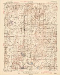
1943 Map of Ina
USGS Topo · Published 1943About this map
Ina and Benton anchor this 1943 survey of southern Illinois, where a dense network of township schools and rural churches defines the social landscape. The map reveals a high concentration of educational institutions, ranging from King College and Conner College to local hubs like Arlington Sch Town Hall. These institutions, alongside landmarks like the State Game Farm, point to a well-established community structure before mid-century consolidation.
Find a feature on this map
130 named features on this map. Tap any name to fly to it.
Don’t see what you’re looking for? This feature index may not catch every label — zoom into the map to look around manually.
Map Details
Editions of this 1943 Ina Map
2 editions found

Other maps of this area

1908 · Galatia
USGS Topo · 1:62,500

1909 · West Frankfort
USGS Topo · 1:62,500

1910 · Herrin
USGS Topo · 1:62,500

1926 · Duquoin
USGS Topo · 1:62,500

1933 · Mount Vernon
USGS Topo · 1:48,000

1936 · Herrin
USGS Topo · 1:62,500

1938 · Galatia
USGS Topo · 1:62,500

1939 · Ina
USGS Topo · 1:62,500

1940 · Mount Vernon
USGS Topo · 1:62,500

1941 · West Frankfort
USGS Topo · 1:62,500