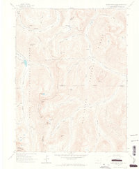
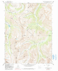
1960 Map of Independence Pass
USGS Topo · Published 1965About this map
The Continental Divide separates the high-altitude drainage systems of the Roaring Fork River and North Fork Lake Creek in this 1960s study of the Sawatch Range. This landscape reflects the intersection of mining history and ambitious water engineering, centered on the historic settlement of Independence. The presence of the New York Collection Canal and the Twin Lakes Reservoir and Canal Co Tunnel No 1 illustrates the complex system of diversions designed to move water across the divide. The map traces the winding route of Independence Pass, connecting the high basins between White River National Forest and San Isabel National Forest. Local mining activity is evidenced by the Ruby Mine near Ruby and scattered Prospects on the slopes of Independence Mountain, while small clusters like Brumley and Everett mark the eastern approach.
Find a feature on this map
50 named features on this map. Tap any name to fly to it.
Don’t see what you’re looking for? This feature index may not catch every label — zoom into the map to look around manually.
Map Details
Editions of this 1960 Independence Pass Map
5 editions found
Other maps of this area

1889 · Leadville
USGS Topo · 1:125,000

1891 · Leadville
USGS Topo · 1:125,000

1909 · Mount Jackson
USGS Topo · 1:125,000

1911 · Mount Jackson
USGS Topo · 1:125,000

1934 · Taylor Park
USGS Topo · 1:62,500

1935 · Mount Elbert
USGS Topo · 1:62,500

1937 · Taylor Park
USGS Topo · 1:62,500

1938 · Mount Elbert
USGS Topo · 1:62,500

1939 · Mount Elbert
USGS Topo · 1:62,500

1942 · Leadville
USGS Topo · 1:125,000