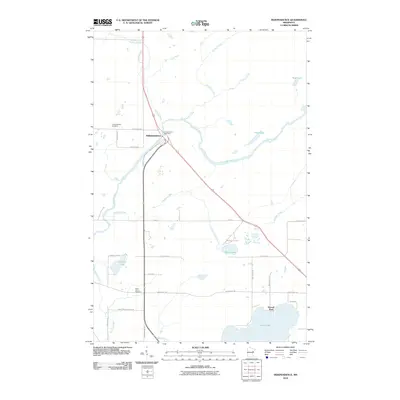
2010 Map of Independence
USGS Topo · Published 2010About this map
The Cloquet River winds through this Saint Louis County landscape, defining the character of the settlement at Independence. The community serves as a crossroads where New Independence Rd meets the regional highway system, with the Independence Rest Area marking a point of transition for travelers. Local history and genealogy are anchored by two distinct burial grounds: Independence Cemetery to the north and Saint Johns Cemetery further south near the river's bend. Numerous bodies of water, including Grand Lake, Beaver Lake, and Sunset Lake, punctuate the terrain, suggesting a region shaped by glacial activity and recreation. Roads such as Erickson Rd and Swan Lake Rd establish a grid that connects rural residences to the natural features of Hellwig Creek and Chicken Creek.
Find a feature on this map
35 named features on this map. Tap any name to fly to it.
Don’t see what you’re looking for? This feature index may not catch every label — zoom into the map to look around manually.
Map Details
Editions of this 2010 Independence Map
This is the sole edition of this map. No revisions or reprints were ever made.
Other maps of this area

1953 · Twig
USGS Topo · 1:24,000

1953 · Canyon
USGS Topo · 1:24,000

1953 · Shaw
USGS Topo · 1:24,000

1953 · Saginaw
USGS Topo · 1:24,000

1953 · Payne
USGS Topo · 1:24,000

1953 · Adolph
USGS Topo · 1:24,000

1953 · Alborn
USGS Topo · 1:24,000

1953 · Brookston
USGS Topo · 1:24,000

1953 · Independence
USGS Topo · 1:24,000

1953 · Duluth
USGS Topo · 1:250,000