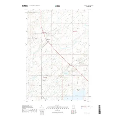
2019 Map of Independence
USGS Topo · Published 2019About this map
Independence sits at the convergence of several county routes and township roads, serving as a focal point for this northern landscape of wetlands and winding waterways. The Cloquet River meanders across the eastern half of the map, fed by a complex drainage system including Chicken Cr and Spring Cr. This environment is punctuated by several significant bodies of water, such as Grand Lake and Sunset Lake, which support the local settlement pattern of the late 2010s.
Find a feature on this map
47 named features on this map. Tap any name to fly to it.
Don’t see what you’re looking for? This feature index may not catch every label — zoom into the map to look around manually.
Map Details
Editions of this 2019 Independence Map
This is the sole edition of this map. No revisions or reprints were ever made.
Other maps of this area

1953 · Twig
USGS Topo · 1:24,000

1953 · Canyon
USGS Topo · 1:24,000

1953 · Shaw
USGS Topo · 1:24,000

1953 · Saginaw
USGS Topo · 1:24,000

1953 · Payne
USGS Topo · 1:24,000

1953 · Adolph
USGS Topo · 1:24,000

1953 · Alborn
USGS Topo · 1:24,000

1953 · Brookston
USGS Topo · 1:24,000

1953 · Independence
USGS Topo · 1:24,000

1953 · Duluth
USGS Topo · 1:250,000