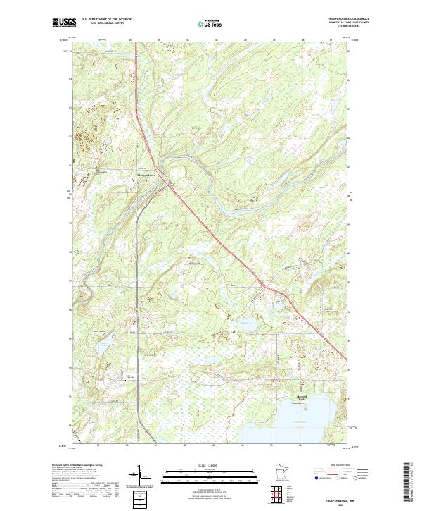
2022 Map of Independence
USGS Topo · Published 2022About this map
Independence serves as the central hub of this St. Louis County landscape, where the Cloquet River and its numerous tributaries like Chicken Cr and Hellwig Cr dominate the topography. The map reveals a transition from these active waterways to a dense concentration of lakes in the south, including Grand Lake, Sunset Lake, and Beaver Lake. Genealogists and local historians can locate the New Independence Cem near the town center and Saint Johns Cem further south along Co HWY 7. A significant piece of industrial history is preserved in the Old Railroad Grade that cuts across the eastern townships, marking the path of former logging or transit routes that once connected these northern woods. The road network, including Co HWY 47 and HWY 8, reflects a pattern of rural development focused around water access and small settlements like Harnell Park.
Find a feature on this map
49 named features on this map. Tap any name to fly to it.
Don’t see what you’re looking for? This feature index may not catch every label — zoom into the map to look around manually.
Map Details
Editions of this 2022 Independence Map
This is the sole edition of this map. No revisions or reprints were ever made.
Other maps of this area

1953 · Twig
USGS Topo · 1:24,000

1953 · Canyon
USGS Topo · 1:24,000

1953 · Shaw
USGS Topo · 1:24,000

1953 · Saginaw
USGS Topo · 1:24,000

1953 · Payne
USGS Topo · 1:24,000

1953 · Adolph
USGS Topo · 1:24,000

1953 · Alborn
USGS Topo · 1:24,000

1953 · Brookston
USGS Topo · 1:24,000

1953 · Independence
USGS Topo · 1:24,000

1953 · Duluth
USGS Topo · 1:250,000