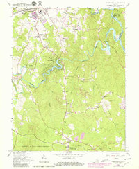
1966 Map of Independent Hill
USGS Topo · Published 1980About this map
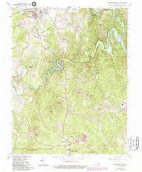
Manassas and its southern environs appear here during a period of transition as the suburbs of Northern Virginia began to push into the rural landscape. The northern portion of the map is anchored by the Old Dominion Speedway and the County Fairgrounds, while the surrounding terrain is defined by the winding course of the Occoquan River and the Occoquan Reservoir. To the south, the village of Brentsville stands as a point of historical interest near the confluence of Broad Run and Cedar Run.
Find a feature on this map
61 named features on this map. Tap any name to fly to it.
Don’t see what you’re looking for? This feature index may not catch every label — zoom into the map to look around manually.
Map Details
Editions of this 1966 Independent Hill Map
5 editions found
Other maps of this area

1890 · Mt. Vernon
USGS Topo · 1:125,000

1891 · Mt. Vernon
USGS Topo · 1:125,000

1894 · Warrenton
USGS Topo · 1:125,000

1894 · Mt. Vernon
USGS Topo · 1:125,000

1897 · Mt. Vernon
USGS Topo · 1:125,000

1915 · Fairfax
USGS Topo · 1:62,500

1927 · Quantico
USGS Topo · 1:62,500

1933 · Middleburg
USGS Topo · 1:62,500

1940 · Quantico
USGS Topo · 1:62,500

1943 · Quantico
USGS Topo · 1:62,500