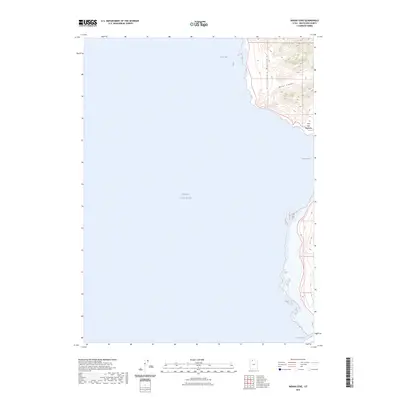
2023 Map of Indian Cove
USGS Topo · Published 2023About this map
The Great Salt Lake dominates this coastal landscape in Box Elder County, where the desert waters meet the steep western slopes of the Promontory Mountains. This area is characterized by dramatic topographic shifts, transitioning from the wide expanse of Rozel Bay and the shoreline at Indian Cove up into the high-elevation terrain of Miller Canyon. A notable aspect of the shoreline hydrology is the Ship Channel located at the southern edge of the survey, indicating specific pathways through the shallow, saline waters. The map provides a precise view of the interface between the lake’s fluctuating levels and the fixed mountain ridges, capturing a moment of contemporary geography in this sparsely settled region of northern Utah.
Find a feature on this map
6 named features on this map. Tap any name to fly to it.
Don’t see what you’re looking for? This feature index may not catch every label — zoom into the map to look around manually.
Map Details
Editions of this 2023 Indian Cove Map
This is the sole edition of this map. No revisions or reprints were ever made.
Other maps of this area

1954 · Brigham City
USGS Topo · 1:250,000

1958 · Brigham City
USGS Topo · 1:250,000

1962 · Brigham City
USGS Topo · 1:250,000

1967 · East Promontory
USGS Topo · 1:24,000

1968 · Messix Peak
USGS Topo · 1:24,000

1968 · Indian Cove
USGS Topo · 1:24,000

1968 · Pokes Point
USGS Topo · 1:24,000

1968 · Rozel Point
USGS Topo · 1:24,000

1968 · Promontory Point
USGS Topo · 1:24,000

1969 · Rozel Point SW
USGS Topo · 1:24,000