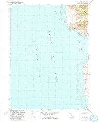
1991 Map of Indian Cove
USGS Topo · Published 1991About this map
The eastern shores of Gunnison Bay meet the steep western face of the Promontory Mountains in this late-twentieth-century study of the Utah shoreline. This specific stretch of the Great Salt Lake is defined by the recession and rise of the waterline, where the Indian Cove and Rozel Bay inlets shape the jagged coast. Landforms like Squaw Flat and Miller Canyon provide a stark contrast to the expansive salt flats and water-bound terrain below. Of particular interest to local historians are the Indian Caves, located along the base of the mountains just above the bay. The map also identifies specific hydrological features such as a Spring (Salt) and the Ship Channel, indicating the area's navigational and natural history near the Promontory peninsula.
Find a feature on this map
14 named features on this map. Tap any name to fly to it.
Don’t see what you’re looking for? This feature index may not catch every label — zoom into the map to look around manually.
Map Details
Editions of this 1991 Indian Cove Map
This is the sole edition of this map. No revisions or reprints were ever made.
Other maps of this area

1954 · Brigham City
USGS Topo · 1:250,000

1958 · Brigham City
USGS Topo · 1:250,000

1962 · Brigham City
USGS Topo · 1:250,000

1967 · East Promontory
USGS Topo · 1:24,000

1968 · Messix Peak
USGS Topo · 1:24,000

1968 · Indian Cove
USGS Topo · 1:24,000

1968 · Pokes Point
USGS Topo · 1:24,000

1968 · Rozel Point
USGS Topo · 1:24,000

1968 · Promontory Point
USGS Topo · 1:24,000

1969 · Rozel Point SW
USGS Topo · 1:24,000