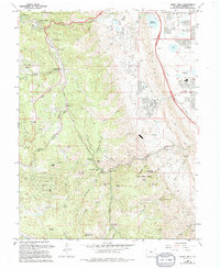
1965 Map of Indian Hills
USGS Topo · Published 1994About this map
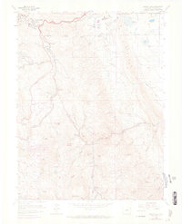
Turkey Creek and its namesake Turkey Creek Canyon carve a prominent path through this 1965 survey of the Front Range foothills. The map details a transition from the lower Dutch Creek drainage toward the high elevations of Plymouth Mountain and Sampson Mtn. Settlement patterns are concentrated in pockets like Indian Hills and the roadside attraction of Tiny Town, while local spiritual life is anchored by Mountain High Chapel and Gilmore Chapel.
Find a feature on this map
68 named features on this map. Tap any name to fly to it.
Don’t see what you’re looking for? This feature index may not catch every label — zoom into the map to look around manually.
Map Details
Editions of this 1965 Indian Hills Map
7 editions found
Other maps of this area

1893 · Platte Canyon
USGS Topo · 1:125,000

1899 · West Denver
USGS Topo · 1:125,000

1938 · Morrison
USGS Topo · 1:24,000

1941 · Fort Logan
USGS Topo · 1:31,680

1942 · Morrison
USGS Topo · 1:31,680

1942 · Littleton
USGS Topo · 1:31,680

1945 · Indian Hills
USGS Topo · 1:31,680

1945 · Platte Canyon
USGS Topo · 1:24,000

1945 · Pine
USGS Topo · 1:24,000

1945 · Kassler
USGS Topo · 1:24,000