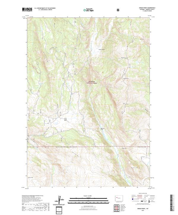
2021 Map of Indian Point
USGS Topo · Published 2021About this map
The high-elevation landscape of the Absaroka Range defines this part of the Shoshone National Forest, where steep ridges and deep drainages form a complex hydrologic network. The Wiggins Fork serves as a primary artery through the terrain, joined by tributaries such as Charlie Cr and Bain Cr. Local topography is marked by several prominent summits and passes, including Black Mtn, Spring Mtn, and the high saddle at Bear Pass. Evidence of seasonal water and natural springs appears at Bog Lakes and Bartrand Spring. Navigation through these mountain reaches relies on established routes like the Horse Creek Trl and Indian Point Trl, which connect the remote Horse Creek Basin to notable lookouts like Indian Point and the transition at Windy Gap.
Find a feature on this map
33 named features on this map. Tap any name to fly to it.
Don’t see what you’re looking for? This feature index may not catch every label — zoom into the map to look around manually.
Map Details
Editions of this 2021 Indian Point Map
This is the sole edition of this map. No revisions or reprints were ever made.
Other maps of this area

1904 · Kirwin
USGS Topo · 1:125,000

1905 · Younts Peak
USGS Topo · 1:125,000

1906 · Kirwin
USGS Topo · 1:125,000

1907 · Younts Peak
USGS Topo · 1:125,000

1955 · Thermopolis
USGS Topo · 1:250,000

1956 · Indian Point
USGS Topo · 1:24,000

1956 · Dubois
USGS Topo · 1:24,000

1956 · Ramshorn Peak
USGS Topo · 1:24,000

1956 · Snow Lake
USGS Topo · 1:24,000

1956 · Five Pockets
USGS Topo · 1:24,000