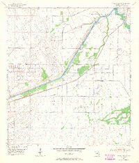
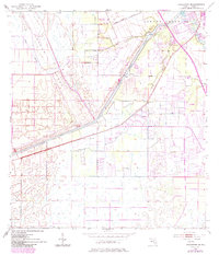
1953 Map of Indian Town SE
USGS Topo · Published 1967About this map
Hanson Grant and the surrounding marshlands define this Florida landscape during the early 1950s, a period of significant hydraulic engineering. The massive St Lucie Canal and the Okeechobee Waterway cut a straight path through the terrain, managed by the St Lucie Lock and Dam to the northeast. These artificial channels contrast sharply with the natural meandering of the South Fork St Lucie River and Roebuck Creek.
Find a feature on this map
18 named features on this map. Tap any name to fly to it.
Don’t see what you’re looking for? This feature index may not catch every label — zoom into the map to look around manually.
Map Details
Editions of this 1953 Indian Town SE Map
6 editions found
Other maps of this area

1948 · Palm City
USGS Topo · 1:24,000

1948 · Rood
USGS Topo · 1:24,000

1948 · St. Lucie Inlet
USGS Topo · 1:24,000

1948 · Gomez
USGS Topo · 1:24,000

1949 · Rood
USGS Topo · 1:24,000

1949 · Gomez
USGS Topo · 1:24,000

1950 · St. Lucie Inlet
USGS Topo · 1:24,000

1950 · Palm City
USGS Topo · 1:24,000

1953 · Indian Town SE
USGS Topo · 1:24,000

1953 · Indian Town NW
USGS Topo · 1:24,000