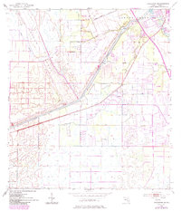
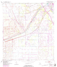
1953 Map of Indiantown SE
USGS Topo · Published 1983About this map
The Okeechobee Waterway and the St Lucie Canal dominate this South Florida landscape, illustrating the massive hydrological engineering efforts of the mid-20th century. At the intersection of these vital water routes, the St Lucie Lock and Dam serves as a focal point for maritime activity and regional water management. The small settlement of Arundel sits alongside the canal, while the surrounding terrain is marked by the Green Ridge and the winding course of Cane Slough. To the northeast, the South Fork St Lucie River flows through the Hanson Grant, an area that includes Phipps Park and a local Fish Hatchery. The introduction of the Toll Road Turnpike represents the expanding transportation infrastructure that began to bisect these traditional wetlands and agricultural tracts during the early 1950s.
Find a feature on this map
14 named features on this map. Tap any name to fly to it.
Don’t see what you’re looking for? This feature index may not catch every label — zoom into the map to look around manually.
Map Details
Editions of this 1953 Indiantown SE Map
6 editions found
Other maps of this area

1948 · Palm City
USGS Topo · 1:24,000

1948 · Rood
USGS Topo · 1:24,000

1948 · St. Lucie Inlet
USGS Topo · 1:24,000

1948 · Gomez
USGS Topo · 1:24,000

1949 · Rood
USGS Topo · 1:24,000

1949 · Gomez
USGS Topo · 1:24,000

1950 · St. Lucie Inlet
USGS Topo · 1:24,000

1950 · Palm City
USGS Topo · 1:24,000

1953 · Indian Town SE
USGS Topo · 1:24,000

1953 · Indian Town NW
USGS Topo · 1:24,000