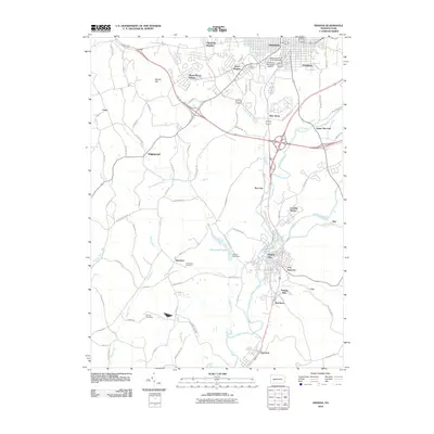
2010 Map of Indiana
USGS Topo · Published 2010About this map
Indiana University of Pennsylvania serves as a prominent institutional anchor in this region, which balances academic life with a legacy of heavy industry. The borough of Indiana is surrounded by residential developments like Getty Heights, Claypoole Heights, and Shado-Wood Village. To the south, the industrial character of the landscape becomes evident near Lucerne Mines and the borough of Homer City. The infrastructure of the area is defined by the valley of Two-Lick Creek, which supports the Cherry Run Dam and its associated reservoir, Cherry Run Lake. Genealogists may find value in the presence of several burial grounds, including Oakland Cemetery and the more rural Smathers Cemetery and Kunkle Cemetery, which mark the transitions between the growing town centers and the outlying countryside of Smathers and Graceton.
Find a feature on this map
85 named features on this map. Tap any name to fly to it.
Don’t see what you’re looking for? This feature index may not catch every label — zoom into the map to look around manually.
Map Details
Editions of this 2010 Indiana Map
This is the sole edition of this map. No revisions or reprints were ever made.
Other maps of this area

1900 · Latrobe
USGS Topo · 1:62,500

1902 · Latrobe
USGS Topo · 1:62,500

1902 · Indiana
USGS Topo · 1:62,500

1902 · Elders Ridge
USGS Topo · 1:62,500

1903 · Latrobe
USGS Topo · 1:62,500

1904 · Elders Ridge
USGS Topo · 1:62,500

1920 · New Florence
USGS Topo · 1:62,500

1921 · New Florence
USGS Topo · 1:48,000

1922 · New Florence
USGS Topo · 1:62,500

1944 · New Florence
USGS Topo · 1:62,500