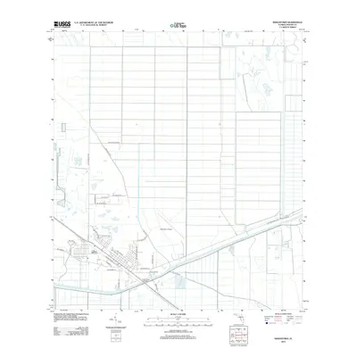
2012 Map of Indiantown
USGS Topo · Published 2012About this map
The Saint Lucie Canal serves as the dominant geographical feature of this Martin County landscape, cutting a straight path through the Florida interior. The settlement pattern reveals a transition from a structured street grid near Railroad Ave and Carrier St to large-scale agricultural and drainage engineering to the north. Industrial and transport legacies are visible through the naming of corridors like SW Minute Maid Rd and SW Citrus Blvd, reflecting the region's agricultural roots. The Indiantown Airport and the Indian Town Bridge highlight the infrastructure required to navigate and manage this low-lying terrain. Residential clusters are organized along streets like SW Indian Mound Dr and SW Osceola St, while the expansive grid of canals and local roads like SW Allapattah Rd illustrate the systematic reclamation of the land for development.
Find a feature on this map
31 named features on this map. Tap any name to fly to it.
Don’t see what you’re looking for? This feature index may not catch every label — zoom into the map to look around manually.
Map Details
Editions of this 2012 Indiantown Map
This is the sole edition of this map. No revisions or reprints were ever made.
Other maps of this area

1948 · Palm City
USGS Topo · 1:24,000

1950 · Palm City
USGS Topo · 1:24,000

1953 · Okeechobee 4 SE
USGS Topo · 1:24,000

1953 · Okeechobee 4 NE
USGS Topo · 1:24,000

1953 · Indian Town SE
USGS Topo · 1:24,000

1953 · Indian Town NW
USGS Topo · 1:24,000

1953 · Indian Town
USGS Topo · 1:24,000

1956 · West Palm Beach
USGS Topo · 1:250,000

1956 · Fort Pierce
USGS Topo · 1:250,000

1957 · West Palm Beach
USGS Topo · 1:250,000