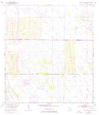
1953 Map of Indiantown NW
USGS Topo · Published 1977About this map
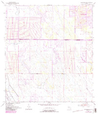
The Allapattah Flats define the landscape of this region during the mid-20th century, revealing a vast wetland environment under heavy modification for water management. The survey documents an intricate system of engineering, including the County Line Canal and numerous structures labeled Levee, which bifurcate the natural drainage of the Green Ridge. These artificial boundaries run alongside the St Lucie Co Martin Co line, showing how political divisions and infrastructure were carved into the Florida interior.
Find a feature on this map
8 named features on this map. Tap any name to fly to it.
Don’t see what you’re looking for? This feature index may not catch every label — zoom into the map to look around manually.
Map Details
Editions of this 1953 Indiantown NW Map
6 editions found
Other maps of this area

1948 · Palm City
USGS Topo · 1:24,000

1948 · Ankona
USGS Topo · 1:24,000

1950 · Ankona
USGS Topo · 1:24,000

1950 · Palm City
USGS Topo · 1:24,000

1953 · Okeechobee 4 SE
USGS Topo · 1:24,000

1953 · Okeechobee 1 SE
USGS Topo · 1:24,000

1953 · Okeechobee 4 NE
USGS Topo · 1:24,000

1953 · Indian Town SE
USGS Topo · 1:24,000

1953 · Indian Town NW
USGS Topo · 1:24,000

1953 · Fort Pierce SW
USGS Topo · 1:24,000