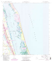
1948 Map of Indrio
USGS Topo · Published 1984About this map
Indian River Aquatic Preserve defines the aquatic geography of this coastal area, where the Intracoastal Waterway threads between the mainland and the barrier island. Grounded by the Florida East Coast railway, the mainland settlements of Indrio and Viking sit near the western edge, while the coastal development of Queens Cove appears on the eastern peninsula. The map illustrates a complex network of mangrove-lined inlets and coves with distinctive names such as Little Starvation Cove, Hells Pocket, and Fish House Cove. Public land and recreation are represented by Jack Island State Recreation Area and Round Island Park, showing the early preservation of Florida's shoreline. The western portion is dominated by the St Lucie County International Airport, marking the area's mid-century infrastructural growth.
Find a feature on this map
41 named features on this map. Tap any name to fly to it.
Don’t see what you’re looking for? This feature index may not catch every label — zoom into the map to look around manually.
Map Details
Editions of this 1948 Indrio Map
4 editions found
Other maps of this area

1948 · Riomar
USGS Topo · 1:24,000

1948 · Indrio
USGS Topo · 1:24,000

1949 · Fort Pierce
USGS Topo · 1:24,000

1949 · Vero Beach
USGS Topo · 1:24,000

1949 · Oslo
USGS Topo · 1:24,000

1949 · Fort Pierce NW
USGS Topo · 1:24,000

1950 · Riomar
USGS Topo · 1:24,000

1950 · Fort Pierce
USGS Topo · 1:24,000

1950 · Fort Pierce NW
USGS Topo · 1:24,000

1950 · Oslo
USGS Topo · 1:24,000