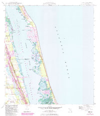
1948 Map of Indrio
USGS Topo · Published 1984About this map
Viking and Indrio anchor the mainland shore of the Indian River during this period of mid-century growth along the Florida coastline. The landscape is defined by the Florida East Coast railway and a network of canals like the South Canal, which supported the region's transition into a modern transportation hub centered on the St Lucie County International Airport. The shoreline is heavily articulated with numerous named coves and points, including the suggestively named Big Starvation Cove and Little Starvation Cove, while the barrier island features evolving residential developments such as Queens Cove. Conservation and leisure spaces are prominent, with the Jack Island State Recreation Area and Indian River Aquatic Preserve protecting the delicate estuarine environment. These map revisions provide a distinct look at the dredging and development of the Intracoastal Waterway and its impact on the surrounding mangrove and marsh terrain.
Find a feature on this map
43 named features on this map. Tap any name to fly to it.
Don’t see what you’re looking for? This feature index may not catch every label — zoom into the map to look around manually.
Map Details
Editions of this 1948 Indrio Map
4 editions found
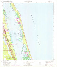
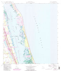
Other maps of this area

1948 · Riomar
USGS Topo · 1:24,000

1948 · Indrio
USGS Topo · 1:24,000

1949 · Fort Pierce
USGS Topo · 1:24,000

1949 · Vero Beach
USGS Topo · 1:24,000

1949 · Oslo
USGS Topo · 1:24,000

1949 · Fort Pierce NW
USGS Topo · 1:24,000

1950 · Riomar
USGS Topo · 1:24,000

1950 · Fort Pierce
USGS Topo · 1:24,000

1950 · Fort Pierce NW
USGS Topo · 1:24,000

1950 · Oslo
USGS Topo · 1:24,000