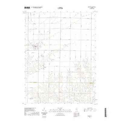
2021 Map of Industry
USGS Topo · Published 2021About this map
Industry serves as the primary hub for this agricultural landscape, situated at the crossing of W Main St and Central Ave. The terrain is defined by a dense concentration of rural burial grounds, suggesting a long history of family farming and local community ties in this corner of the state. These sites, including Vail Cem, Claybaugh Cem, and Wilhelm Cem, are dispersed among the headwaters of numerous waterways such as Grindstone Creek and Carter Creek. As the land transitions south toward the McDonough and Schuyler county line, the topography becomes increasingly dissected by drainage branches like Rich Branch and Wolfden Branch. This detailed survey preserves the precise locations of small-scale landmarks such as Peck Cem and Shockley Cem, which are essential for tracing lineage and property history in the region.
Find a feature on this map
84 named features on this map. Tap any name to fly to it.
Don’t see what you’re looking for? This feature index may not catch every label — zoom into the map to look around manually.
Map Details
Editions of this 2021 Industry Map
This is the sole edition of this map. No revisions or reprints were ever made.
Other maps of this area

1912 · Macomb
USGS Topo · 1:62,500

1914 · Macomb
USGS Topo · 1:62,500

1918 · Vermont
USGS Topo · 1:62,500

1921 · Vermont
USGS Topo · 1:62,500

1923 · Rushville
USGS Topo · 1:62,500

1926 · Beardstown
USGS Topo · 1:62,500

1926 · Rushville
USGS Topo · 1:62,500

1944 · Beardstown
USGS Topo · 1:62,500

1947 · Vermont
USGS Topo · 1:24,000

1947 · Adair
USGS Topo · 1:24,000