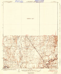
1937 Map of Ingalls
USGS Topo · Published 1937About this map
The Ouachita River winds through the southwestern corner of this territory, where the bottomlands meet a series of prominent ridges including Sand Ridge and Garrett Ridge. This mid-1930s landscape is defined by its rural infrastructure, centered on the Chicago Rock Island and Pacific railroad which cuts diagonally across the townships of Washington, Eagle, and Palestine. The area maintains a high density of community landmarks from the early 20th century, notably a network of small schoolhouses like Newton Sch and Broad Sch, alongside local spiritual centers such as Crossroads Ch.
Find a feature on this map
56 named features on this map. Tap any name to fly to it.
Don’t see what you’re looking for? This feature index may not catch every label — zoom into the map to look around manually.
Map Details
Editions of this 1937 Ingalls Map
3 editions found
Other maps of this area

1933 · Strong
USGS Topo · 1:62,500

1934 · Ingalls
USGS Topo · 1:48,000

1934 · Felsenthal
USGS Topo · 1:62,500

1934 · Moro Bay
USGS Topo · 1:62,500

1937 · Strong
USGS Topo · 1:62,500

1937 · Felsenthal
USGS Topo · 1:62,500

1937 · Ingalls
USGS Topo · 1:62,500

1938 · Felsenthal
USGS Topo · 1:62,500

1938 · Moro Bay
USGS Topo · 1:62,500

1939 · Felsenthal
USGS Topo · 1:62,500