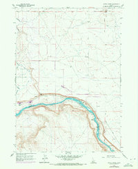
1957 Map of Initial Point
USGS Topo · Published 1972About this map
Initial Point serves as the geographic anchor for this landscape, marking the intersection of the Boise Base Line and the Boise Meridian from which all property surveys in Idaho originate. The terrain transitions from the high volcanic plateau down to the deeply carved canyon of the Snake River. This 1957 survey (with 1971 revisions) illustrates the extensive irrigation infrastructure essential to the region's development, including the Waldvogel Canal, Summit Lat, and Southern Lateral. Evidence of early settlement and river-based activity appears along the canyon floor at Priest Ranch and the nearby Ferry. The presence of a Flume and Gaging Sta further highlights the managed nature of the water resources. Near the volcanic butte of Guffey, the landscape is marked by Halverson Lake and numerous ephemeral springs, contrasting the arid uplands with the lush river corridor.
Find a feature on this map
19 named features on this map. Tap any name to fly to it.
Don’t see what you’re looking for? This feature index may not catch every label — zoom into the map to look around manually.
Map Details
Editions of this 1957 Initial Point Map
4 editions found
Other maps of this area

1892 · Bisuka
USGS Topo · 1:125,000

1892 · Silver City
USGS Topo · 1:125,000

1894 · Bisuka
USGS Topo · 1:125,000

1894 · Silver City
USGS Topo · 1:125,000

1898 · Silver City
USGS Topo · 1:125,000

1947 · Wild Horse Butte
USGS Topo · 1:24,000

1948 · Wild Horse Butte
USGS Topo · 1:24,000

1948 · Sinker Butte
USGS Topo · 1:24,000

1949 · Sinker Butte
USGS Topo · 1:24,000

1949 · Oreana
USGS Topo · 1:62,500