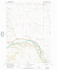
1957 Map of Initial Point
USGS Topo · Published 1985About this map
Initial Point stands as the fundamental geographic marker for Idaho's cadastral surveys, situated at the intersection of the Boise Base Line and the Boise Meridian. This 1957 record, updated with 1970s aerial data, captures the arid landscape where the plateau drops sharply into the Snake River canyon. The presence of the Waldvogel Canal and the Southern Lateral illustrate the complex irrigation infrastructure required to sustain agriculture in this high desert environment.
Find a feature on this map
17 named features on this map. Tap any name to fly to it.
Don’t see what you’re looking for? This feature index may not catch every label — zoom into the map to look around manually.
Map Details
Editions of this 1957 Initial Point Map
4 editions found
Other maps of this area

1892 · Bisuka
USGS Topo · 1:125,000

1892 · Silver City
USGS Topo · 1:125,000

1894 · Bisuka
USGS Topo · 1:125,000

1894 · Silver City
USGS Topo · 1:125,000

1898 · Silver City
USGS Topo · 1:125,000

1947 · Wild Horse Butte
USGS Topo · 1:24,000

1948 · Wild Horse Butte
USGS Topo · 1:24,000

1948 · Sinker Butte
USGS Topo · 1:24,000

1949 · Sinker Butte
USGS Topo · 1:24,000

1949 · Oreana
USGS Topo · 1:62,500