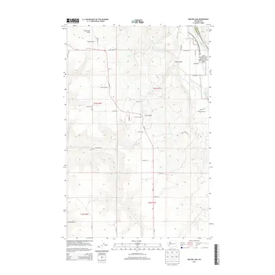
2013 Map of Inkster Lake
USGS Topo · Published 2013About this map
Egypt serves as a central point of reference in this landscape on the edge of the Lake Roosevelt National Recreation Area. The terrain is defined by a series of deep drainage features, including Bockemuehl Canyon and Snook Canyon in the north, while the Spokane River Arm marks the northeastern boundary where Lincoln and Stevens counties meet. Historically significant sites like the North Star Grange along Wa-25 indicate the area's agricultural community roots. A network of local ranch and access roads, such as Mule Ranch Rd N and Curliss Ranch Dr N, weave through the draws and flats between Green Canyon and Trinkle Canyon, illustrating how the modern road system still follows the complex contours of the Columbia River's drainage basins.
Find a feature on this map
40 named features on this map. Tap any name to fly to it.
Don’t see what you’re looking for? This feature index may not catch every label — zoom into the map to look around manually.
Map Details
Editions of this 2013 Inkster Lake Map
This is the sole edition of this map. No revisions or reprints were ever made.
Other maps of this area

1948 · Lincoln
USGS Topo · 1:62,500

1948 · Turtle Lake
USGS Topo · 1:62,500

1950 · Lincoln
USGS Topo · 1:62,500

1950 · Turtle Lake
USGS Topo · 1:62,500

1953 · Ritzville
USGS Topo · 1:250,000

1959 · Ritzville
USGS Topo · 1:250,000

1965 · Ritzville
USGS Topo · 1:250,000
1969 · Mondovi
USGS Topo · 1:24,000

1969 · Rocklyn
USGS Topo · 1:24,000
1969 · Davenport
USGS Topo · 1:24,000