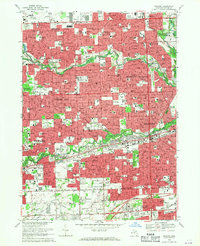
1968 Map of Inkster
USGS Topo · Published 1970About this map
Wayne County’s westward expansion is frozen in time across the suburban landscapes of Livonia, Garden City, and Inkster. The map captures a high-density period of residential growth defined by an extensive network of parochial and public schools, such as Nankin Mills Sch and St Mel's Sch, interspersed with local landmarks like the Dearborn Country Club. The Lower Rouge River and Middle Rouge River corridors serve as central recreational and geographic spines, flanked by the Hines Parkway and the Lower Rouge Parkway.
Find a feature on this map
162 named features on this map. Tap any name to fly to it.
Don’t see what you’re looking for? This feature index may not catch every label — zoom into the map to look around manually.
Map Details
Editions of this 1968 Inkster Map
Other maps of this area

1905 · Wayne
USGS Topo · 1:62,500

1905 · Detroit
USGS Topo · 1:62,500

1906 · Wyandotte
USGS Topo · 1:62,500

1906 · Romulus
USGS Topo · 1:62,500

1912 · Wyandotte
USGS Topo · 1:62,500

1912 · Wayne
USGS Topo · 1:62,500

1918 · Detroit
USGS Topo · 1:62,500

1924 · Detroit
USGS Topo · 1:62,500

1928 · Romulus
USGS Topo · 1:62,500

1929 · Wyandotte
USGS Topo · 1:62,500