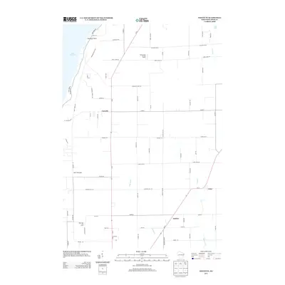
2013 Map of Institute
USGS Topo · Published 2013About this map
Lake Michigan defines the western edge of this coastal landscape along the Door Peninsula. Small unincorporated settlements serve as local hubs for the surrounding rural road network, including Carlsville, Valmy, and the town of Institute in the southeastern corner. The interior geography is marked by several minor watercourses such as Lilly Bay Cr, Geisel Cr, and Logan Cr, while Lost Lake sits tucked into the northeastern corner near the junction of several county roads.
Find a feature on this map
64 named features on this map. Tap any name to fly to it.
Don’t see what you’re looking for? This feature index may not catch every label — zoom into the map to look around manually.
Map Details
Editions of this 2013 Institute Map
This is the sole edition of this map. No revisions or reprints were ever made.
Other maps of this area

1954 · Escanaba
USGS Topo · 1:250,000

1954 · Manitowoc
USGS Topo · 1:250,000

1957 · Escanaba
USGS Topo · 1:250,000

1958 · Escanaba
USGS Topo · 1:250,000

1958 · Manitowoc
USGS Topo · 1:250,000

1960 · Sturgeon Bay
USGS Topo · 1:62,500

1960 · Jacksonport
USGS Topo · 1:62,500

1960 · Sister Bay
USGS Topo · 1:62,500

1961 · Chambers Island
USGS Topo · 1:62,500

1981 · Sturgeon Bay West
USGS Topo · 1:24,000