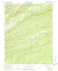
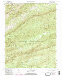
1965 Map of Interior
USGS Topo · Published 1983About this map
Peters Mountain and Potts Mountain dominate this mid-1960s survey of the borderlands between Giles County, Virginia, and Monroe County, West Virginia. The landscape is defined by the high ridges of the Jefferson National Forest, where the Appalachian Trail winds past Bailey Gap and the Stony Creek Lookout Tower on its way toward the heights of War Spur. In the valleys, small settlements like Interior and Rock Camp anchor the rural landscape, connected by tracks like the Bradley Trail.
Find a feature on this map
56 named features on this map. Tap any name to fly to it.
Don’t see what you’re looking for? This feature index may not catch every label — zoom into the map to look around manually.
Map Details
Editions of this 1965 Interior Map
5 editions found
Other maps of this area

1887 · Hinton
USGS Topo · 1:125,000

1887 · Lewisburg
USGS Topo · 1:125,000

1890 · Dublin
USGS Topo · 1:125,000

1890 · Christiansburg
USGS Topo · 1:125,000

1891 · Lewisburg
USGS Topo · 1:125,000

1891 · Dublin
USGS Topo · 1:125,000

1892 · Hinton
USGS Topo · 1:125,000

1921 · Alderson
USGS Topo · 1:48,000

1921 · Ronceverte
USGS Topo · 1:48,000

1923 · Ronceverte
USGS Topo · 1:62,500