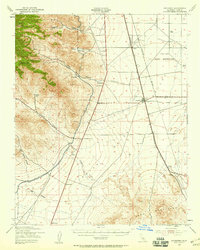
1943 Map of Inyokern
USGS Topo · Published 1958About this map
The Southern Pacific railroad line and the Los Angeles Aqueduct define the industrial and logistical backbone of this desert landscape during the early 1940s. Centered on the town of Inyokern, the map reveals a region transitioning from isolated ranching outposts like Carr Ranch and Stayer Ranch to a strategic military hub, evidenced by the expansive U S Naval Reservation.
Find a feature on this map
32 named features on this map. Tap any name to fly to it.
Don’t see what you’re looking for? This feature index may not catch every label — zoom into the map to look around manually.
Map Details
Editions of this 1943 Inyokern Map
4 editions found
Other maps of this area

1903 · Randsburg
USGS Topo · 1:62,500

1906 · Kernville
USGS Topo · 1:125,000

1908 · Kernville
USGS Topo · 1:125,000

1911 · Randsburg
USGS Topo · 1:62,500

1912 · Randsburg
USGS Topo · 1:62,500

1915 · Searles Lake
USGS Topo · 1:250,000

1915 · Mojave
USGS Topo · 1:125,000

1943 · Inyokern
USGS Topo · 1:62,500

1943 · Cross Mountain
USGS Topo · 1:62,500

1943 · Saltdale
USGS Topo · 1:62,500